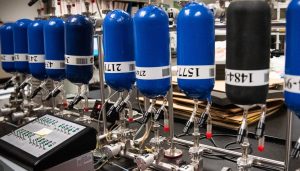
|
|
 |
Water Resources and Hydrology
Quantity and quality of the Nation's water resources has
been and will continue to be critically important to ensure, protection
of life and property, economic well-being, and healthy coastal ecosystems.
Moreover, in light of the alarming decline in water supplies in certain
regions of the U.S. and world-wide, protecting and preserving vital water
resources in the future will depend largely on sound management decisions
supported by an in-depth, reliable scientific knowledge base. Key to this
base is the full understanding of the hydrological cycle, the natural
process by which water circulates among air, land, and water. Across NOAA
Research, scientists are using hydrology, a scientific assessment of the
volume, location and movement of water to build complex mathematical models
to understand the intricacies of this vital cycle
A key component of this work is directed at the Great Lakes
that represent one-fifth of the earth's supply of surface fresh water
supply (95% of the U.S. supply). For three decades, the scientific products,
services and expertise of the Great Lakes Environmental Research Laboratory
(GLERL) have provided critical data and scientific insight that managers
and policy makers need to make informed, cost-effective decisions in managing
and protecting these vital resources. Additionally, research, extension,
communications, and educational activities of the seven Great Lakes Sea
Grant programs have provided a wide array of scientific products and expertise
to a diverse and widespread community of Great Lakes user groups, managers
and decision makers.
Elsewhere in the U.S., NOAA's's National Severe Storms
Laboratory (NSSL), Atlantic Oceanographic and Meteorological Laboratory
(AOML), Earth System Research Laboratory (ESRL), and Climate Program
Office (CPO) are carrying out both large- and small-scale research projects
focused on supporting informed hydrological understanding of water resources
needed to ensure protection of life and property, economic heath, and
sustained management and protection of these vital resources.
Great Lakes Environmental Research Laboratory (GLERL)
- Distributed
Large Basin Runoff Model
The DLBRM is an integrated, spatially
distributed, physically-based water quality model to evaluate both
agricultural non-point source loading from soil erosion, fertilizers,
animal manure, and pesticides, and point source loadings at the watershed
level.
- Great
Lakes Water Levels
Great
Lakes Sea Grant Network
- A network of Sea Grant colleges and programs working in partnership
with government and the private sector to meet the changing needs of
Americans living in the Great Lakes region
National Severe Storms Laboratory (NSSL)
- Quantitative Precipitation Estimation and Segregation Using Multiple
Sensors(QPESUMS)
The goal of QPESUMS is to research, develop, and deploy multisensor
precipitation algorithms that are adaptable to different types of weather
for flash flood, river flood, agricultural, and water resources management
applications worldwide. Originally prototyped for use in the mountainous
terrain of the southwest US, QPESUMS uses a unique blend of WSR-88D
radar data, TDWR radar data, private sector C-band radar data, satellite
imagery, lightning strikes, rain gauge data, surface and upper air observations,
and numerical model output to estimate precipitation types and rates
on a 1x1 km grid, every 5 minutes.
- Algorithms
developed to date include: 3-D Refelectivity Mosaic; Hybrid Scans;
Brightband Identification; Convective-Stratiform Segregation; Calibration
of Satellite by Radar; Verification Software; and Radar Calibration
Diagnostics.
- QPESUMS
deployment sites include: Arizona; Oklahoma; North and South
Carolina; and Taiwan.
Atlantic Oceanographic and Meteorological Laboratory (AOML)
- Coastal
Ocean Water Resources: Links With Terrestrial Freshwater Resources,
Anthropogenic Influences and Climate Change
Earth System Research Laboratory (ESRL)
- Hydrometeorology
Testbed (HMT) - improved hydrometeorological and hydrologic
forecasts of precipitation and runoff by establishing and demonstrating
a hydrometeorological testbed (HMT) in a vulnerable northern California
watershed.
- Western
Water Assessment (WWA) works within an evolving social context
to increase the relevance and value of scientific information to improve
decisionmaking leading to effective management of water resources in
the western United States.
Climate Program Office (CPO)
- Climate Prediction Program for the Americas (CPPA)
CPPA seeks to improve intraseasonal to interannual climate predictions
to improve climate-based hydrologic forecasting capabilities and decision
support tools for water resource applications.
- NOAA
Water Cycle Project
NOAA is in the beginning stage of developing a NOAA water cycle program
to support CCRI
(Climate Change Research Initiative) and USGCRP (U.S.
Global Change Research Program) water cycle activities. The mission
of the NOAA water cycle program is to improve the prediction and evaluation
of water system risks.
|
|